Preview
Identifier
Map 3-sm
Creation Date
1730
Description
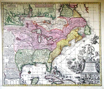
ca. 1730, copied from Henri Chatelain’s map of 1719
62 x 50 cm., hand colored
Settler’s fine map of eastern North America was copied from Henri Chatelain’s Carta del la Nouvelle France, published in 1719.This example is typical of the high standard of German maps of this period. The map covers the area from what is now the Mexican border to Hudson Bay and eastern Canada. The decorative cartouche illustrates the Mississippi Bubble financial crisis. Cherubs are preparing and selling shares of the Mississippi company, while on the left side of the cartouche eager buyers are literally falling out of the trees to buy the stock.
Keywords
Eighteenth Century maps, ancient maps, Carlton D. Weaver Map Collection, Matthaeis Seutteri, Henri Chatelain, Mississippi Bubble
