Preview
Creation Date
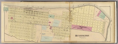
1876
Description
Size: 32 x 12 cm. (12.7 x 4 in.)
E. L. Hays thoroughly mapped cities, towns, and counties from Pittsburg, PA to Cincinnati, Ohio, along the Ohio River.
1876
Size: 32 x 12 cm. (12.7 x 4 in.)
E. L. Hays thoroughly mapped cities, towns, and counties from Pittsburg, PA to Cincinnati, Ohio, along the Ohio River.

Home | About | FAQ | My Account | Accessibility Statement
Trademarked and copyrighted images and insignia are the exclusive property of Marshall University.