The Cabell-Wayne Historical Society Vertical Files consist of a variety of topics related to the Huntington, Ohio, and Kentucky regions of the United States. The collection covers the time period from the 1880s to the time of the Cabell-Wayne Historical Society's closure in 1974. The boxes were arranged in alphabetical order based on topic.
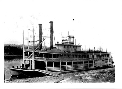
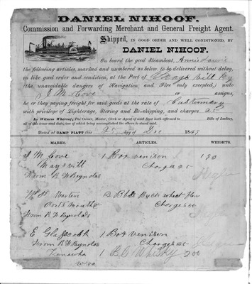
The bulk of the vertical file collection relates to activities, events, buildings, and personalities of the Cabell County, West Virginia tri-state area of southwestern West Virginia, southeastern Ohio, and eastern Kentucky. The collection includes material related to the Civil War, railroads and transportation in West Virginia, the first banks in the city of Huntington, bank robberies, church directories, court records of West Virginia and Kentucky, parks, hospitals, census records, genealogy records, obituaries, and many miscellaneous topics. These topics are presented as advertisements, stories, ads, newspaper clippings, journals, letters, pamphlets, and books. The bulk of the collection consists of newspaper clippings, many of which are in very fragile condition.
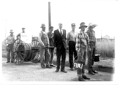
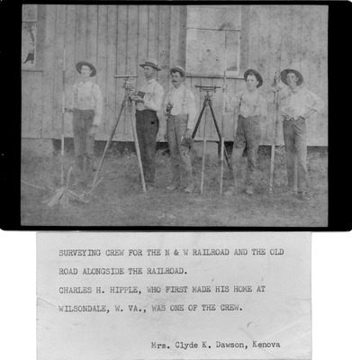
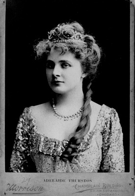
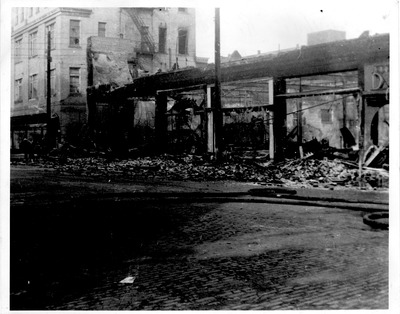
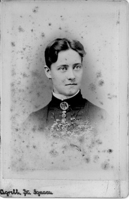
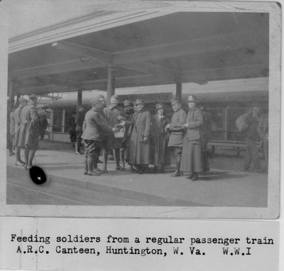
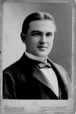
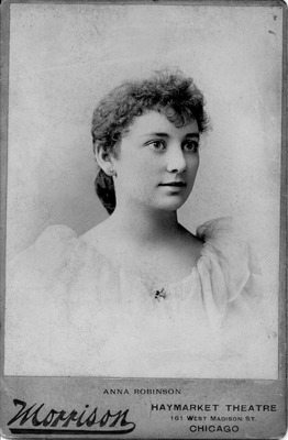
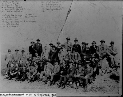
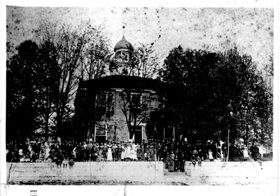
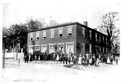
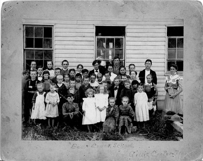
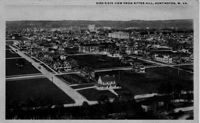
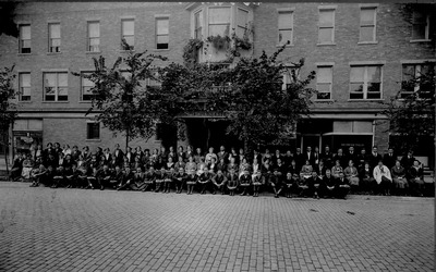
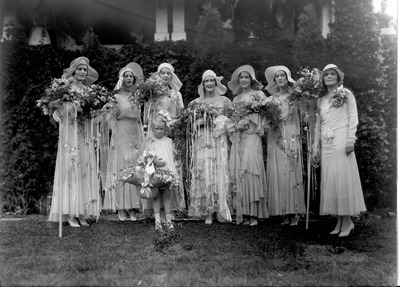
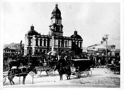
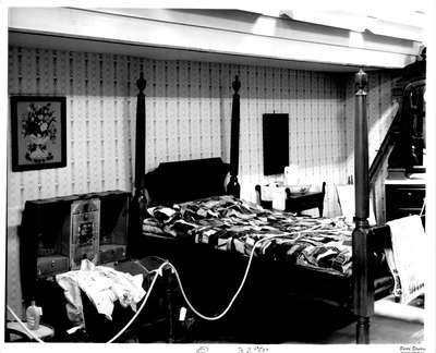
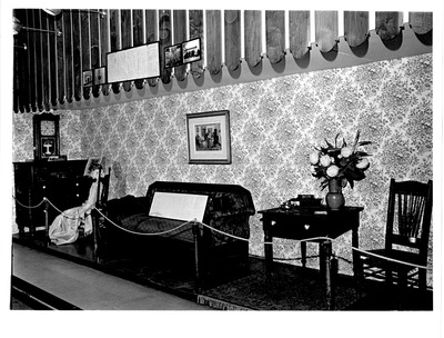
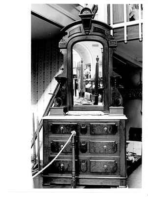
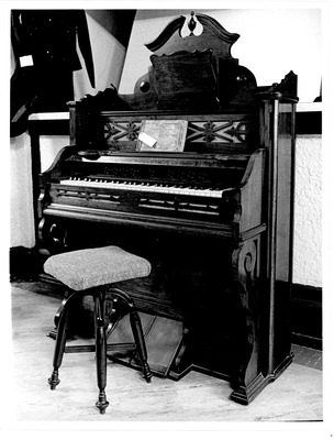
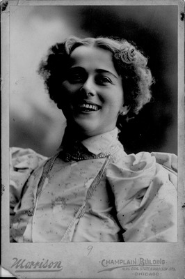
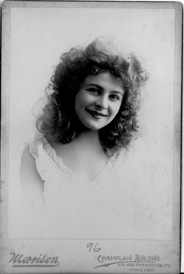
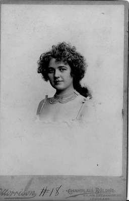
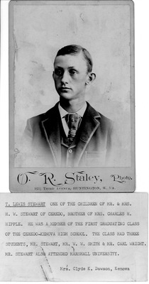
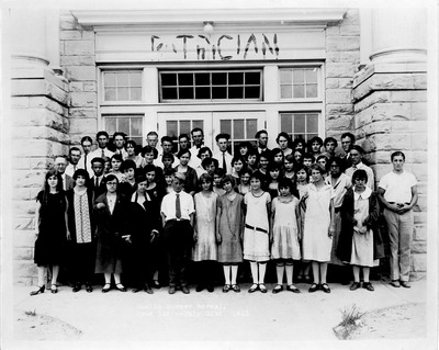
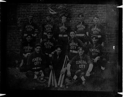
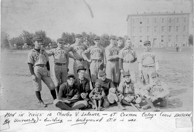
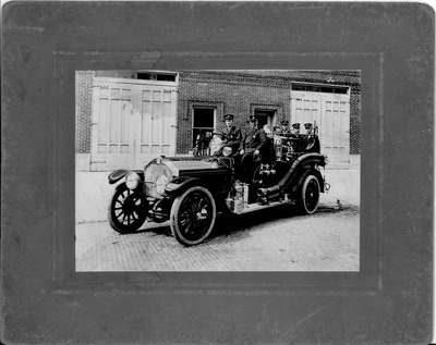
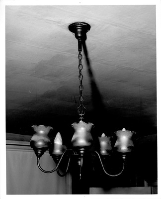
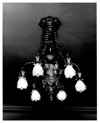
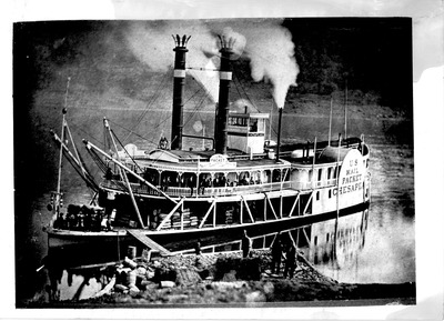
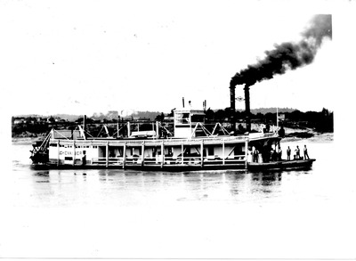
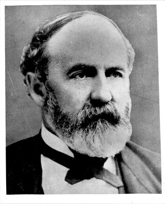
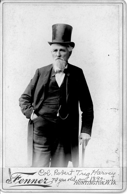
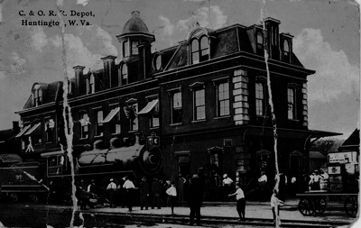
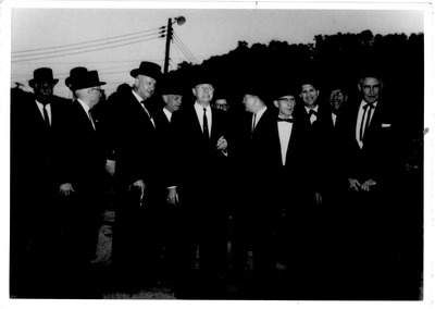
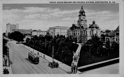
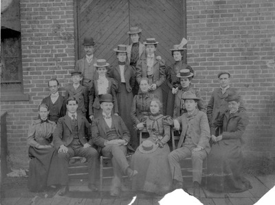
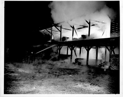
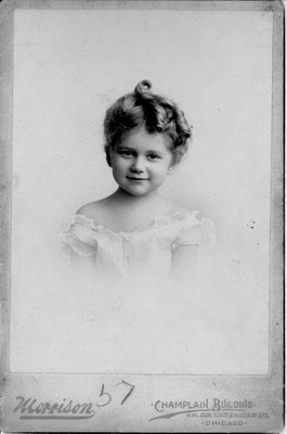
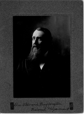
The collection of photographs relates to the people, places and events that surrounded Cabell and Wayne counties in West Virginia. The bulk of the collection relates to the families that have lived in the region, such as the Buffingtons. The rest of the collection includes significant events, including political campaigns, soldiers from various wars, parades, and different buildings at different times. Specific items of interest are a picture of General Robert E. Lee at White Sulfur Springs, WV in 1869, The American Red Cross Canteen at the C & O Railroad during WWI, Theodore Roosevelt's 1912 Bullmoose party campaign stop at the Cabell County Courthouse, and Wendell Wilke's 1940 presidential campaign stop in Huntington. Another portion of the collection is dedicated to the floods that have occurred over time, with the bulk of that dedicated to the 1937 flood.
The digitized items here do not represent the entirety of the Cabell-Wayne Historical Society Collection. To view what other materials are in this collection but not yet digitized and available online, search the guide to the Cabell-Wayne Historical Society Collection.
-

Fort Sumter, February, 1865, View from southwestern angle and the gorge
Fort Sumter, February, 1865, View from southwestern angle and the gorge, 18.5x12.5cm Fort Sumter as it was during the War, showing the effects of the bombardment by Maj. John Johnson, Engineer at Fort Sumter Publisher: Walker, Evans & Cogswell Co.,Charleston, S.C. Compliments of J. F. Weruer, Sullivans Island, S.C. Sergent Charles E. Walker, Battery M. 1 artillery, Sullevans Island, South Carlina The exterior of the Gorge, the interior view with the western or city-front of the Fort. This illustration is from a photograph taken soon after the evacuation, which accounts for the "look-out station," seen over the crest of the gorge. It was erected by the Union authorities, and though apparently on the gorge, was really at the eastern angle of the Fort, entirely accross its area, and nearly oppostie Fort Moultrie. The shoal in the foreground was bare only at low water. The original height of the Fort, forty feet, carefully preserved in at least one place, all through its destructive bombardments, is seen at its south-western angle. The exterior slope of the gorge was practicable for assualt during most of the years '63 and '64, and in fact up to the end; and it was necessary to place obstructions on it every night, and take them in before daylight every morning. Some of the iron rods, carrying wire entanglements, have been left, and appear on the crest of the gorge.
-
")
Fort Sumter, February 2nd, 1864, Flag showing result of four days' use, June 20th, 1864, replacing the flag on the gorge wall, ( from a sketch by Maj. John Johnson)
Fort Sumter, February 2nd, 1864, Flag showing result of four days' use, June 20th, 1864, replacing the flag on the gorge wall, ( from a sketch by Maj. John Johnson), 18.5x12.5cm Fort Sumter as it was during the War, showing the effects of the bombardment by Maj. John Johnson, Engineer at Fort Sumter Publisher: Walker, Evans & Cogswell Co.,Charleston, S.C. Compliments of J. F. Weruer, Sullivans Island, S.C. Sergent Charles E. Walker, Battery M. 1 artillery, Sullevans Island, South Carlina This scene of flag-raising occurred over the "central bomb-proof," on the 20th June, 1864, and was conspicuous among the many such acts of gallantry, on account of the greatest and longest exposure of person involved. The principal actor was Lieutenant Charles H. Claiborne, of the First South Carolina Infantry (Regulars), from Maryland. He and his assistants were complimented by General Beauregard, in a General Order from Department Headquarters. The scene, and the flags on the same page, are reproduced from sketches by an officer on duty at the time in the Fort.
-

Fort Sumter, March 1864, interior of east battery, with palmetto shield
Fort Sumter, March 1864, interior of east battery, with palmetto shield, 18.5x12.5cm From a photo Fort Sumter as it was during the War, showing the effects of the bombardment by Maj. John Johnson, Engineer at Fort Sumter Publisher: Walker, Evans & Cogswell Co.,Charleston, S.C. Compliments of J. F. Weruer, Sullivans Island, S.C. Sergent Charles E. Walker, Battery M. 1 artillery, Sullevans Island, South Carlina Period of the greatest ruin. To obtain a cross-fire from Fort Sumter with the works on Sullivan's Island, Fort Moultrie and others, three guns were mounted as described in the lowere casemates of Sumter near the eastern angle; but the outer wall having been much shaken and weakened by the naval fire of the attack, resort was had to a crib-work of logs (palmetto) projecting ten feet outside of the wall, filled with debris, and pierced with embrasures for short range firing upon the main channel. Had the armored vessels ever attempted to run past into the harbor, these guns behind their cracked brick wall, strengthened by a palmetto shield, might have done some service; as it happened they were never called into action. The upright irons placed along the water's edge of the sea-front, served the two-fold purpose of retaining other horizontally laid irons for a footing to the slope of tide and storm-washed debris, and of carrying strong iron wires from post to post, in the way of obstruction and entanglement. Evidence of the great loss of material to the fort is shown in the large blocks of masonry fallen from about to the water's edge.
-

Fort Sumter, 1862-1863, map of Charleston Harbor
Fort Sumter, 1862-1863, map of Charleston Harbor, 18.5x12.5cm Fort Sumter as it was during the War, showing the effects of the bombardment by Maj. John Johnson, Engineer at Fort Sumter Publisher: Walker, Evans & Cogswell Co.,Charleston, S.C. Compliments of J. F. Weruer, Sullivans Island, S.C. Sergent Charles E. Walker, Battery M. 1 artillery, Sullevans Island, South Carlina Places where Engagements, Battles, or Bombardments occurred between 1861 and 1865. MORRIS ISLAND.-Firing on "Star of the West," 9th January, 1861. Cumming's Point engaged with Sumter, 12th-13th April, 1861. Batteies on south end bombarded and captured. 10th July, 1863, Battery Wagner repulsed, 1st assault, 11th July 1863. Battery Wagner repulsed, 2nd assualt, 18th July, 1863. Battery Wagner after siege of 58 days, evacuated, 6th September, 1863. Battery Gregg, Cumming's Point, repulsed assault 5th September, 1863. Engaged and evacuated same time as Wagner. FORT SUMTER.-Major Anderson's bombardment and surrender 12th-13th April, 1861. Repulsed attack of armored squadron 7th April 1863. Fort demolished, repulsed attack by small boats, 9th September 1863. Remodeled, rearmed, and after eleven bombardments, during 280 days, evacuated with the city, 18th February, 1865. JAMES ISLAND.-Fort Johnson, mortar battery, first to open on Fort Sumter, 12th April, 1861. Legare's place, skirmish at, 3rd June, 1862. Secessionville, battle, with repulse of Union Army, 16th June, 1862. Stono River, capture of gunboats, by field batteries, 30th January 1863. Stono River, in vicinity of, land and water engagement, 16th July, 1863. River's Causeway, skirmish, with loss of two Confederate guns, 2nd July, 1864. Fort Johnson repulsed assault, 3rd July 1864. Stono Batteries engaged for eight days and nights, 5th July, 1864. Battery Simkins engaged Union works, Morris Island, from August, 1863, to 1865. Rifle pits a Grimball's attacked and captured, 10th February, 1865. Island evacuated with city, 18th February, 1865. SULLIVAN'sISLAND.-Fort Moultrie engaged bombarding Sumter, 12th-13th April, 1861. Fort Moultrie, Battery Bee, Battery Beauregard, engaged in repulse of armored squadron, 7th April, 1863. Battery Marion, Battery Rutledge, Battery Marshall, engaged with the above named in defending the entrance to harbor after Sumter was demolished, 7th September, 1863, to 18th February, 1865.
-

Fort Sumter, December 1863, bird's eye view of interior after second great bombardment
Fort Sumter, December 1863, bird's eye view of interior after second great bombardment, 18.5x12.5cm Fort Sumter as it was during the War, showing the effects of the bombardment by Maj. John Johnson, Engineer at Fort Sumter Publisher: Walker, Evans & Cogswell Co.,Charleston, S.C. Compliments of J. F. Weruer, Sullivans Island, S.C. Sergent Charles E. Walker, Battery M. 1 artillery, Sullevans Island, South Carlina Period of the greatest ruin. The view is not in the least exaggerated; it was taken at the time by a special draughtsman, and shows the increased ruin of the Fort, due to a second great bombardment some few months after the first, and in the end of the year 1863. Some places show the work of repair and remodeling begun, and continued thenceforth almost uninterruptedly, through the fire. The sea-wall is battered down in places to half its original height. The station of the armored squadron is shown off Morris Island, which had then been evacuated by confederates. The shore of Sullivan's Island is seen on the left in the distance. The fore-groung is the crest of the western or city-wall.
-

Fort Sumter, December 1863, bird's eye view of interior after second great bombardmentFort Sumter, December 1863, interior of eastern angle of sea face, from a drawing by Lt. John E. Key
Fort Sumter, December 1863, interior of eastern angle of sea face, from a drawing by Lt. John E. Key, 18.5x12.5cm Fort Sumter as it was during the War, showing the effects of the bombardment by Maj. John Johnson, Engineer at Fort Sumter Publisher: Walker, Evans & Cogswell Co.,Charleston, S.C. Compliments of J. F. Weruer, Sullivans Island, S.C. Sergent Charles E. Walker, Battery M. 1 artillery, Sullevans Island, South Carlina Period of the greatest ruin. The interior of the eastern angle of the Fort. The crest of the sea-front on the right is hardly twenty feet above the water; the waves in a high wind dash their spray over it. The ladder is necessary to the garrison for manning the wall in any night assult. The slope of debris on the ourside can be ascended by the enemy landing from small boats. A furnace once used for heating shot is seen on the left; a rejected iron tank once used for a cistern is on the right; a pool of water has formed in one of the many low places, where the parade has been excavated to fill the casemates on the sea-face. But the most important feature in the picture is the opening, through slanted logs, into one of the "bomb-proofs," being three lower casemates opposite Sullivan's Island, armed with three heavy guns bearing on the channel, and protected in revierse from the enemy's fire from Morris Island by heavy filling of earth, sloping down to the parade.
-

Fort Sumter, December 1863, interior of eastern angle of gorge, from a drawing by Lt. John E. Key
Fort Sumter, December 1863, interior of eastern angle of gorge, from a drawing by Lt. John E. Key, 18.5x12.5cm Fort Sumter as it was during the War, showing the effects of the bombardment by Maj. John Johnson, Engineer at Fort Sumter Publisher: Walker, Evans & Cogswell Co.,Charleston, S.C. Compliments of J. F. Weruer, Sullivans Island, S.C. Sergent Charles E. Walker, Battery M. 1 artillery, Sullevans Island, South Carlina Period of the greatest ruin. This highly typical sketch shows the interior of the south-eastern angle of the Fort, the nearest to Morris Island. The flag staff at this angle was frequently shot away, and replaced with distinguished gallantry. The wide and deep cut, made in the crest of the gorge wall, was a much exposed point. The eastern end of the principal bomb-proof is shown with its slanting logs and sand-bags for protection. The rooms of the gorge being all filled with sand and wet cotton bales, proved indestructible through all the bombardment.
-

Fort Sumter, September 1863, interior, looking north, after first great bombardment
Fort Sumter, September 1863, interior, looking north, after first great bombardment, 18.5x12.5cm Fort Sumter as it was during the War, showing the effects of the bombardment by Maj. John Johnson, Engineer at Fort Sumter Publisher: Walker, Evans & Cogswell Co.,Charleston, S.C. Compliments of J. F. Weruer, Sullivans Island, S.C. Sergent Charles E. Walker, Battery M. 1 artillery, Sullevans Island, South Carlina Occupied by the Confederates. Repaired and completed on its original plans, Fort Sumter became the Citadel of Charleston Harbor, with a garrison of 550 artillerists, and an armament of about 80 guns. From the attack by DuPont's armored squadron in April, 1863, the Fort suffered little, not enough to change its appearance on the exerrior. But, when in the summer of the same year, the breaching batteries of rifle cannon, directed by Gereral Gillmore, opened on the Fort from Morris Island, assisted by the armored squadron, the demolition of the work was brought about in one week, and the silencing of its guns soon followed. The appearance of the interior of the Fort, after this first bombarddment, is seen in the photo-view presented in the photo. The observer is looking northwardly from the level of the parade towards the salient and its two adjacent faces. On the left, a single gun in barbette is pointed toward the city; the flag staff is seen at the eastern angle of the sea-face, or right flank, opposite Fort Moultrie, while the upper casemates of three side of the Fort, and both the eastern and western barracks are destroyed. The gorge is not seen, being in the fore-ground; its upper part was destroyed, but its mass remained indestructible to the end. No work of repair or refitting had yet been done.
-

Gen. Albert Gallatin Jenkins
Barta Studios
Confederate Gen. Albert Gallatin Jenkins, 25.5x22.5cm Exact same photo in Library of Congress identified as Jenkins.


