This collection consists primarily of aerial photographs of Huntington taken on May 2, 1972 at 3500 feet. Other later additions to the collection, in significantly smaller amounts, include Huntington East High School memorabilia belonging to Richard S. Mobayed, unidentified group photographs, a photo of the Owens-Illinois Glass Company Plant, a limited amount of correspondence from Louis’ daughter Carole Eddins and son Richard S. Mobayed, programs from Louis’ Huntington High School reunions, and a diploma for Louella Hatfield from 1927.
The digitized items here do not represent the entirety of the Louis A. Mobayed Collection, 1927-1991. To view what other materials are in this collection but not yet digitized and available online, search the guide to the Louis A. Mobayed Collection, 1927-1991.
-

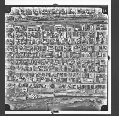
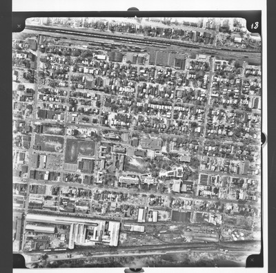
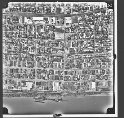
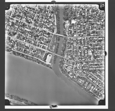
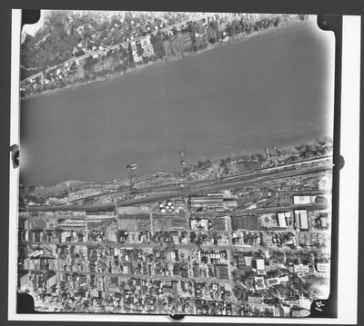
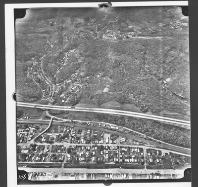
20th to 14th Sts, Ohio River to 5th Ave, Huntington, W.Va.
Army Corps of Engineers
Aerial view, b&w: 20th to 14th Streets, Ohio River to 5th Ave (South), Huntington, W.Va.Taken at altitude of 3500 feet. Army Corps of Engineers photo.
-

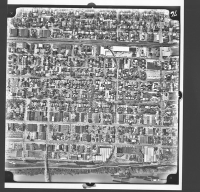
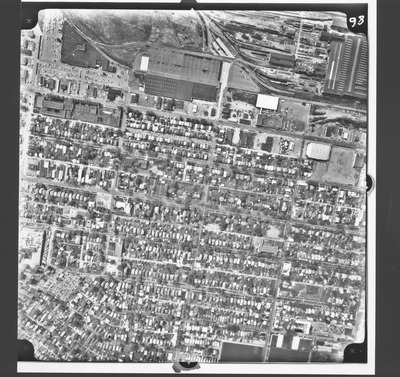
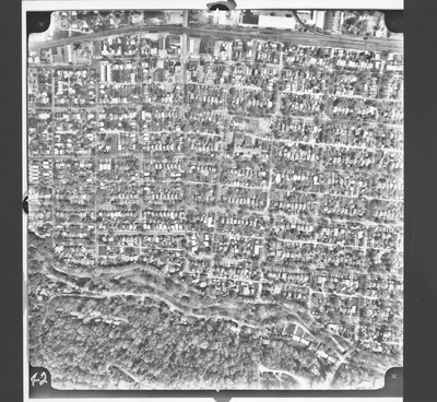
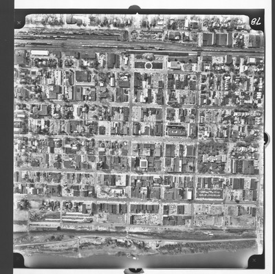
20th to 24th Sts, 7th Ave to 3rd Ave., Huntington, W.Va.
Army Corps of Engineers
Aerial view, b&w: 20th to 24th Streets, 7th Ave to 3rd Ave, (North) Huntington, W.Va.Taken at altitude of 3500 feet. Army Corps of Engineers photo.
-

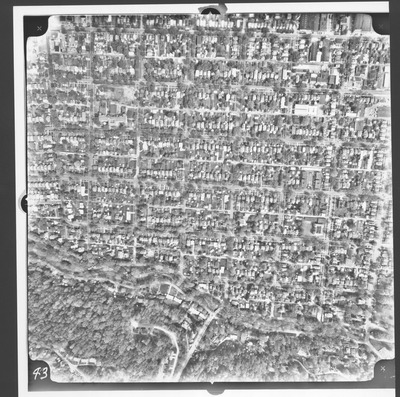
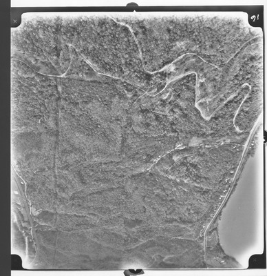
20th to 26th Sts, Spring Hill Cemetery to 8th Ave., facing N, Huntington, W.Va.
Army Corps of Engineers
Aerial view, b&w: 20th to 26th Streets, Spring Hill Cemetery to 8th Ave, facing North, Huntington, W.Va.Taken at altitude of 3500 feet. Army Corps of Engineers photo.
-
, Huntington, W.Va. by Army Corps of Engineers")
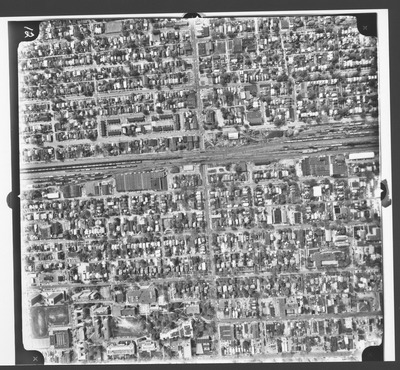
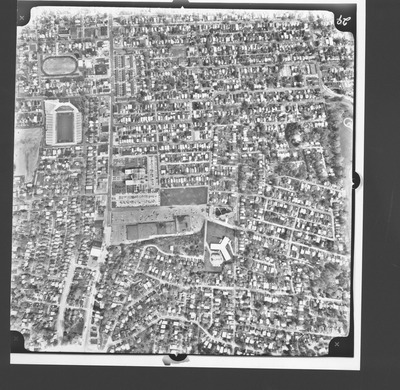
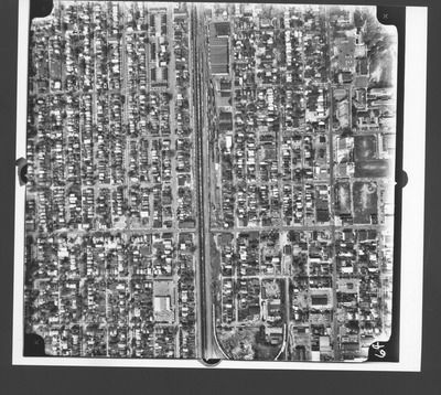
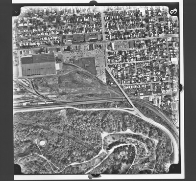
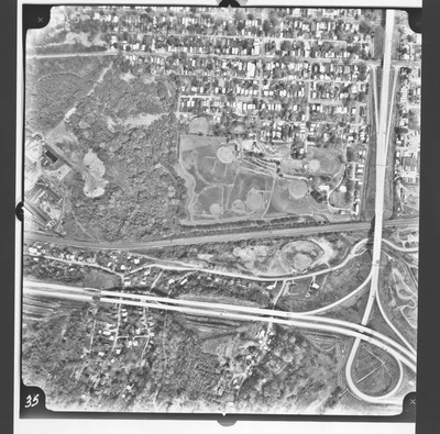
22nd to 17th Streets,4th to 10th Ave. (South), Huntington, W.Va.
Army Corps of Engineers
Aerial view, b&w: 22nd to 17th Streets, 4th to 10th Ave. (South), Huntington, W.Va.Taken at altitude of 3500 feet. Army Corps of Engineers photo.
-

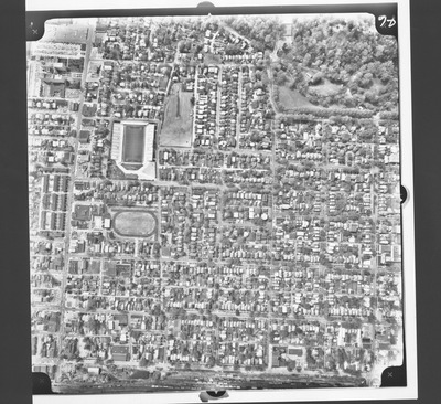
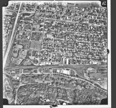
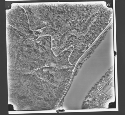
22nd to 28th Streets, Spring Hill Cem. to 8th AVe, Huntington, W.Va.
Army Corps of Engineers
Aerial view, b&w: 22nd to 28th Streets, Spring Hill Cemetery to 8th Ave (N), Huntington, W.Va.Taken at altitude of 3500 feet. Army Corps of Engineers photo.
-
, Huntington, W.Va. by Army Corps of Engineers")
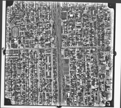
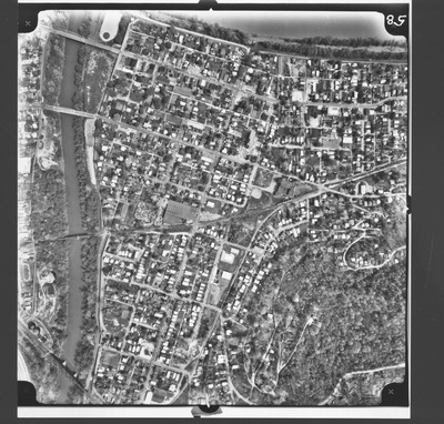
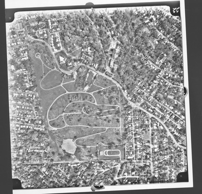
23rd to 20th Streets, 10th to 3rd Ave. (South), Huntington, W.Va.
Army Corps of Engineers
Aerial view, b&w: 23rd to 20th Streets, 10th to 3rd Ave. (South), Huntington, W.Va.Taken at altitude of 3500 feet. Army Corps of Engineers photo.
-

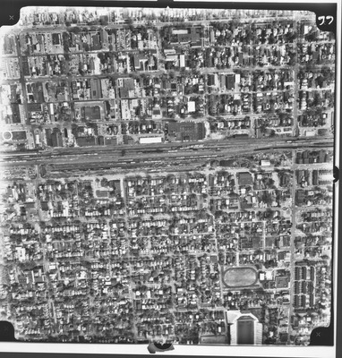
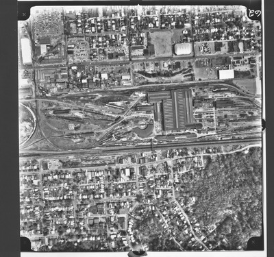
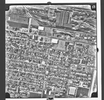
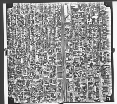
23rd to 26th Sts, 7th to 1st Ave, Huntington, W.Va.
Army Corps of Engineers
Aerial view, b&w: 23rd to 26th Streets,7th Ave to 1st Ave, (North) Huntington, W.Va.Taken at altitude of 3500 feet. Army Corps of Engineers photo.
-

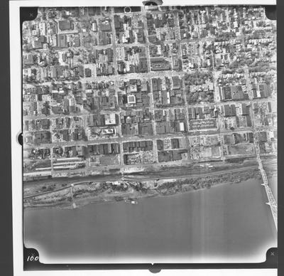
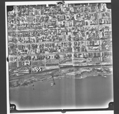
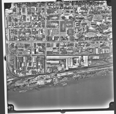
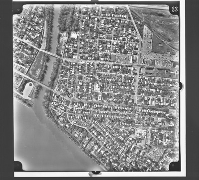
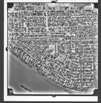
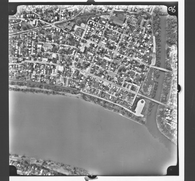
23rd to Elm Sts, Ohio River to 5th Ave, Huntington, W.Va.
Army Corps of Engineers
Aerial view, b&w: 23rd to Elm Streets, Ohio River to 5th Ave (South), Huntington, W.Va.Taken at altitude of 3500 feet. Army Corps of Engineers photo.
-

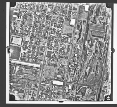
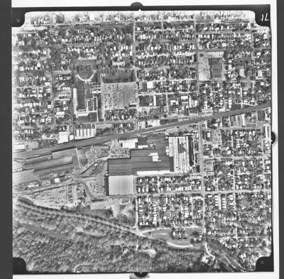
24th to 27th Sts, 7th Ave to Emmons Ave, Huntington, W.Va.
Army Corps of Engineers
Aerial view, b&w: 24th to 27th Streets, 7th Ave to Emmons Ave, (North) Huntington, W.Va.Taken at altitude of 3500 feet. Army Corps of Engineers photo.
-
, Huntington, W.Va. by Army Corps of Engineers")
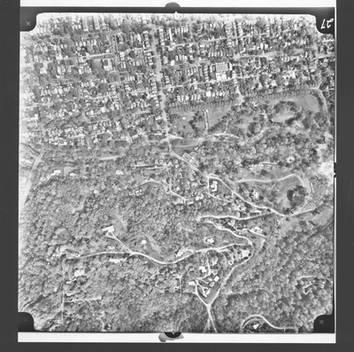
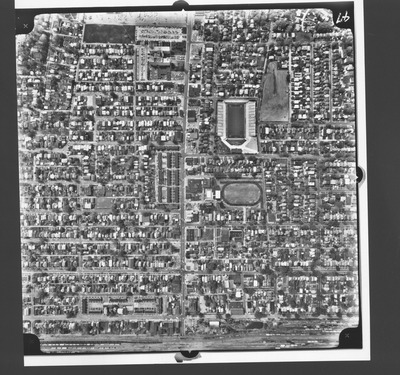
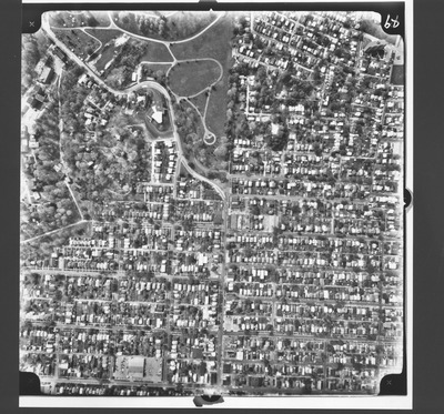
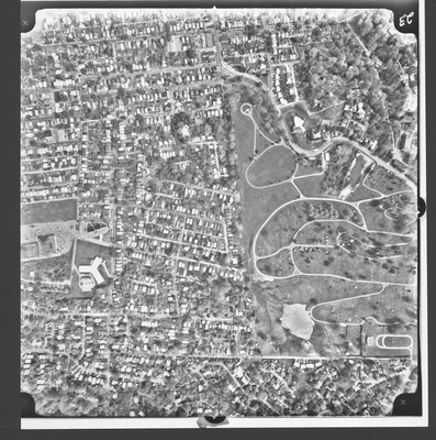
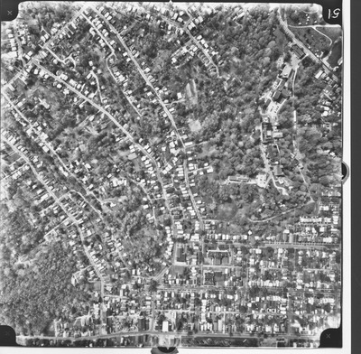
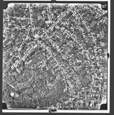
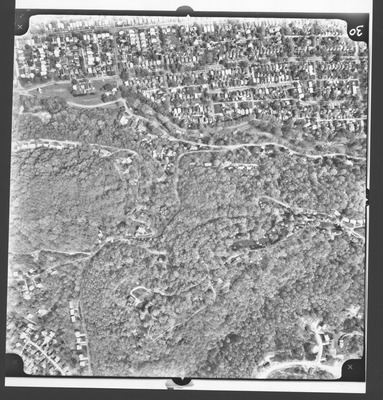
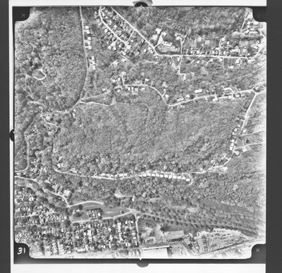
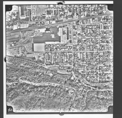
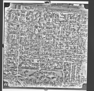
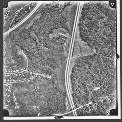
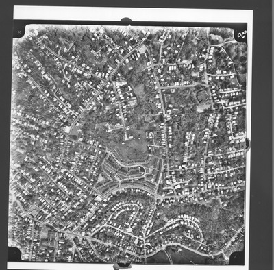
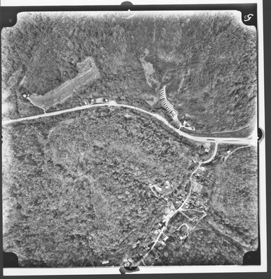
25th St to Overlook Dr, Hollywood Pl to Overlook Dr (N), Huntington, W.Va.
Army Corps of Engineers
Aerial view, b&w: 25th Street to Overlook Drive, Hollywood Place to Overlook Dr. (N), Huntington, W.Va.Taken at altitude of 3500 feet. Army Corps of Engineers photo.
-
, Huntington, W.Va. by Army Corps of Engineers")
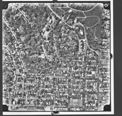
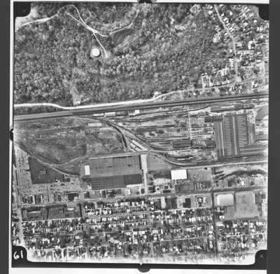
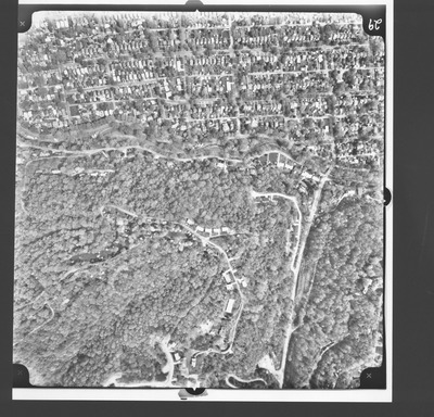
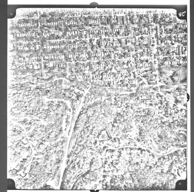
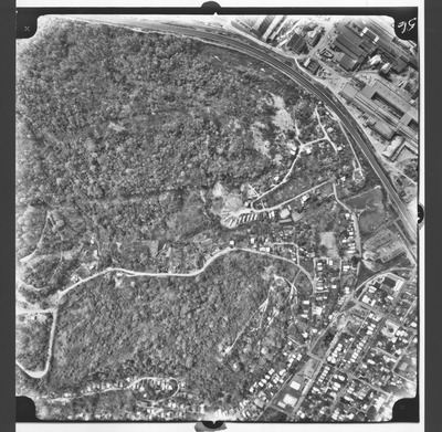
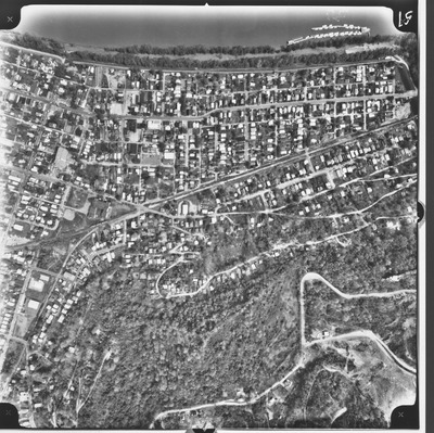
25th St to Overlook Dr, Oney Ave to 8th Ave (N), Huntington, W.Va.
Army Corps of Engineers
Aerial view, b&w: 25th Street to Overlook Drive, Oney Ave to 8th Avenue, (N), Huntington, W.Va.Taken at altitude of 3500 feet. Army Corps of Engineers photo.
-

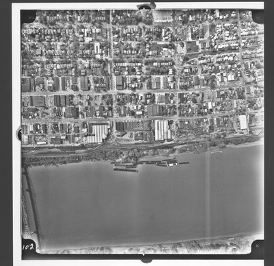
25th to 20th Sts, Ohio River to 5th Ave, Huntington, W.Va.
Army Corps of Engineers
Aerial view, b&w: 25th to 20th Streets, Ohio River to 5th Ave (South), Huntington, W.Va.Taken at altitude of 3500 feet. Army Corps of Engineers photo.
-

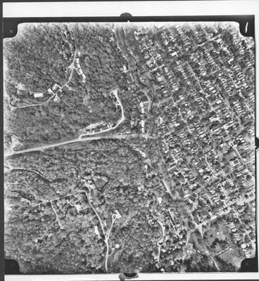
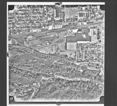
26th to 28th Sts, 7th Ave to Staunton Rd., Huntington, W.Va.
Army Corps of Engineers
Aerial view, b&w: 26th to 28th Streets, 7th Ave to Staunton Rd., (North) Huntington, W.Va.Taken at altitude of 3500 feet. Army Corps of Engineers photo.
-

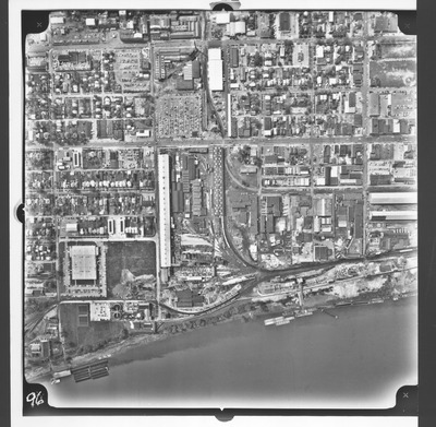
27th to 24th Sts, Ohio River to 5th Ave, Huntington, W.Va.
Army Corps of Engineers
Aerial view, b&w: 27th to 24th Streets, Ohio River to 5th Ave (South), Huntington, W.Va.Taken at altitude of 3500 feet. Army Corps of Engineers photo.
-

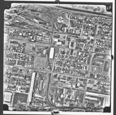
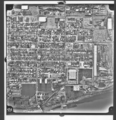
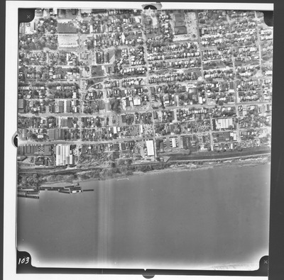
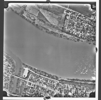
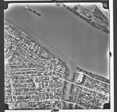
27th to 31st Sts, 6th Ave to Ohio River., Huntington, W.Va.
Army Corps of Engineers
Aerial view, b&w: 27th to 31st Sts, 6th Ave to Ohio River., (North) Huntington, W.Va.Taken at altitude of 3500 feet. Army Corps of Engineers photo.
-
, Huntington, W.Va. by Army Corps of Engineers")
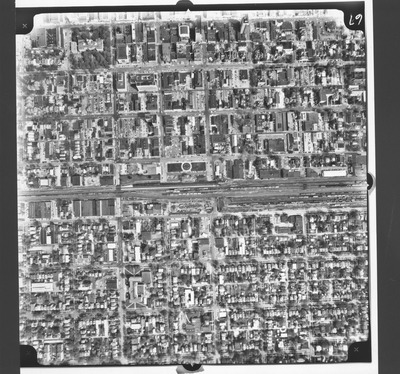
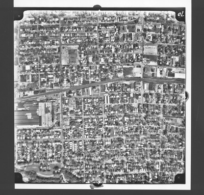
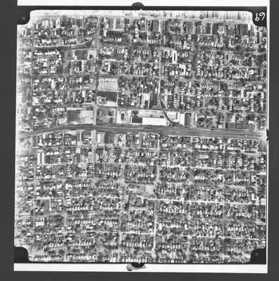
27 to 24th Streets, 10th to 3rd Ave. (South), Huntington, W.Va.
Army Corps of Engineers
Aerial view, b&w: 27 to 24th Streets, 10th to 3rd Ave. (South), Huntington, W.Va.Taken at altitude of 3500 feet. Army Corps of Engineers photo.
-

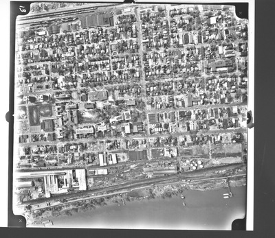
28th to 26th Sts, Ohio River to 5th Ave, Huntington, W.Va.
Army Corps of Engineers
Aerial view, b&w: 28th to 26th Streets, Ohio River to 5th Ave (South), Huntington, W.Va.Taken at altitude of 3500 feet. Army Corps of Engineers photo.
-
, Huntington, W.Va. by Army Corps of Engineers")
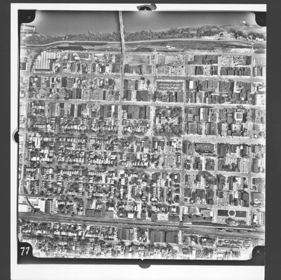
29th to 26 Streets, Overlook Dr to 3rd Ave. (South), Huntington, W.Va.
Army Corps of Engineers
Aerial view, b&w: 29th to 26th Streets, Overlook Dr to 3rd Ave. (South), Huntington, W.Va.Taken at altitude of 3500 feet. Army Corps of Engineers photo.
-

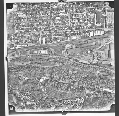
29th to Guyan Sts, 6th Ave to Ohio River., Huntington, W.Va.
Army Corps of Engineers
Aerial view, b&w: 29th to Guyan Sts, 6th Ave to Ohio River, (North) Huntington, W.Va.Taken at altitude of 3500 feet. Army Corps of Engineers photo.
-

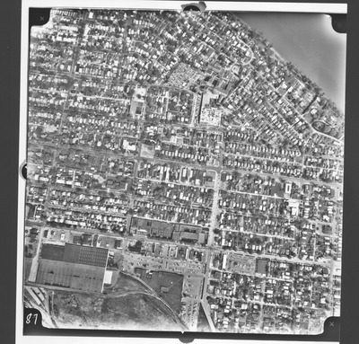
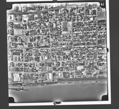
2nd St East to 7th St West, Ohio River to 7th Ave, Huntington, W.Va.
Army Corps of Engineers
Aerial view, b&w: 2nd St East to 7th St West, Ohio River to 7th Ave, (South), Huntington, W.Va.Taken at altitude of 3500 feet. Army Corps of Engineers photo.
-

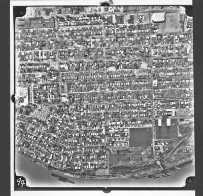
2nd St W to 8th St W, Ohio River to Adams Ave, Huntington, W.Va.
Army Corps of Engineers
Aerial view, b&w: 2nd St W to 8th St W, Ohio River to Adams Ave, (South), Huntington, W.Va.Taken at altitude of 3500 feet. Army Corps of Engineers photo.
-

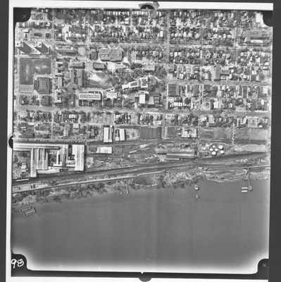
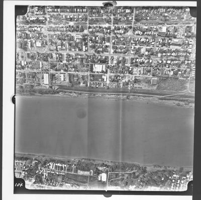
30th to Shorts Sts., 6th Ave to Ohio River., Huntington, W.Va.
Army Corps of Engineers
Aerial view, b&w: 30th to Shorts Sts, 6th Ave to Ohio River, (North) Huntington, W.Va.Taken at altitude of 3500 feet. Army Corps of Engineers photo.
-
, Huntington, W.Va. by Army Corps of Engineers")
31st St to 27 St, 4th Ave to Overlook Dr (South), Huntington, W.Va.
Army Corps of Engineers
Aerial view, b&w: 31st Street to 27th Street, 4th Ave to Overlook Dr. (South), Huntington, W.Va.Taken at altitude of 3500 feet. Army Corps of Engineers photo.
-

31st to 27th Sts, Ohio River to 5th Ave, Huntington, W.Va.
Army Corps of Engineers
Aerial view, b&w: 31st to 27th Sts, Ohio River to 5th Ave (South), Huntington, W.Va.Taken at altitude of 3500 feet. Army Corps of Engineers photo.
-
, Huntington, W.Va. by Army Corps of Engineers")
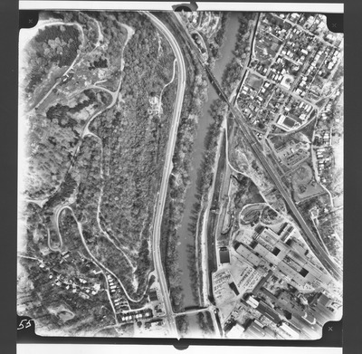
3rd - 8th Sts,W, Monroe Ave to washington Blvd (South), Huntington, W.Va.
Army Corps of Engineers
Aerial view, b&w:3rd to 8th Streets, West, Monroe Ave to Washington Blvd, (South), Huntington, W.Va.Taken at altitude of 3500 feet. Army Corps of Engineers photo.
