Carlton D. "Buck" Weaver was born in Grantsville, West Virginia, in 1921. Graduating from The Citadel in 1939, he entered Marshall College (now Marshall University) in Huntington, West Virginia that same year. Following his service as a dive bomber pilot in WWII, Weaver returned to school at West Virginia University, graduating with a degree in Petroleum Engineering in 1948. He worked for Ashland Oil, Inc. for 30 years.
His ancestors were among the first to move into the land that later became West Virginia, emigrating from Pennsylvania, after emigrating from Germany. He became fascinated with the land on which his ancestors lived and traveled. He had a love of maps and so began devoting his spare time to collecting maps of the TransAllegheny region. Weaver’s collecting took him to map dealers throughout the United States, as well as London. He took great pride in his ancestors and the land they occupied as depicted in the early North American maps he collected. In 1992 he donated “The Carlton D. Weaver TransAllegheny Map Collection” to Marshall University, where it is currently housed in the Archives and Special Collections Department in Morrow Library.
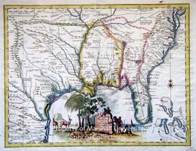
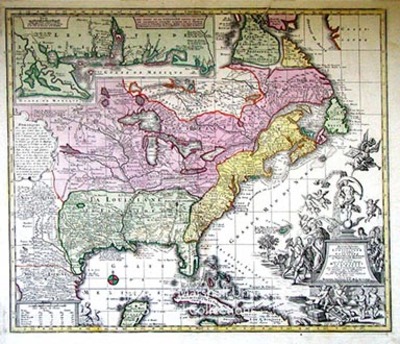
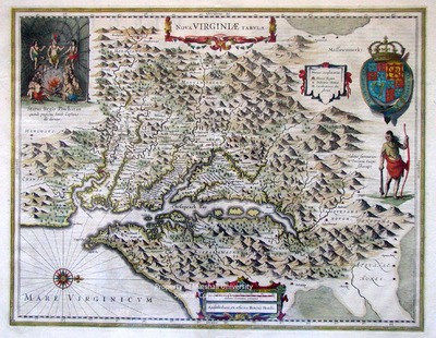
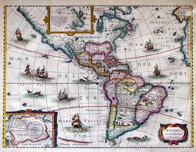
This collection consists of 33 early American maps documenting the Trans-Allegheny region between 1631 and 1881 collected by Carlton D. Weaver. Sizes, formats, and printing processes vary greatly. Of particular note are maps featuring railroads and coal. Maps numbered 12 and 13 are high-quality reproductions; the others are original.
The digitized items here do not represent the entirety of the Carlton D. "Buck" Weaver Map Collection. To view what other materials are in this collection but not yet digitized and available online, search the guide to the Carlton D. "Buck" Weaver Map Collection.
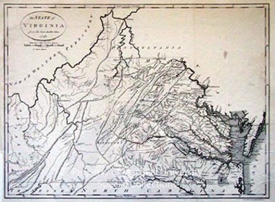
![The State of Virginia from the Best Authorities [Facsimile by Andrew V. Graham Co., Washington, D.C., not dated] by Jean Lattre](https://mds.marshall.edu/sc_weaver/1012/thumbnail.jpg "The State of Virginia from the Best Authorities [Facsimile by Andrew V. Graham Co., Washington, D.C., not dated] by Jean Lattre")
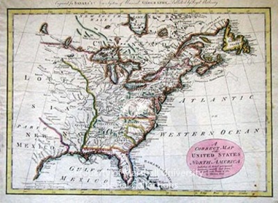
![A Correct Map of the United States of North America, including the British and Spanish Territories, carefully laid down agreeable to the Treaty of 1784. [From Banks. A New and Complete System of Universal Geography.] by Thomas Bowen](https://mds.marshall.edu/sc_weaver/1010/thumbnail.jpg "A Correct Map of the United States of North America, including the British and Spanish Territories, carefully laid down agreeable to the Treaty of 1784. [From Banks. A New and Complete System of Universal Geography.] by Thomas Bowen")
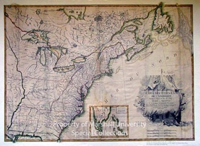
![Carte des Etatis-Unis l'Amerique suicant le Traite de Paix de 1783 [Reproduction by Donnelley & Sons, 1970] by Jean Lattre](https://mds.marshall.edu/sc_weaver/1011/thumbnail.jpg "Carte des Etatis-Unis l'Amerique suicant le Traite de Paix de 1783 [Reproduction by Donnelley & Sons, 1970] by Jean Lattre")


